More than 40 percent of Rio de Janeiro's municipal territory sits inside protected green areas, yet the vast majority of the city's 7 million residents can name a trail that sees almost no foreign foot traffic. These aren't secret trails exactly — they appear on maps, they're maintained by city agencies, and on Saturday mornings they fill with locals in running shoes. They just don't make the tour bus itinerary.
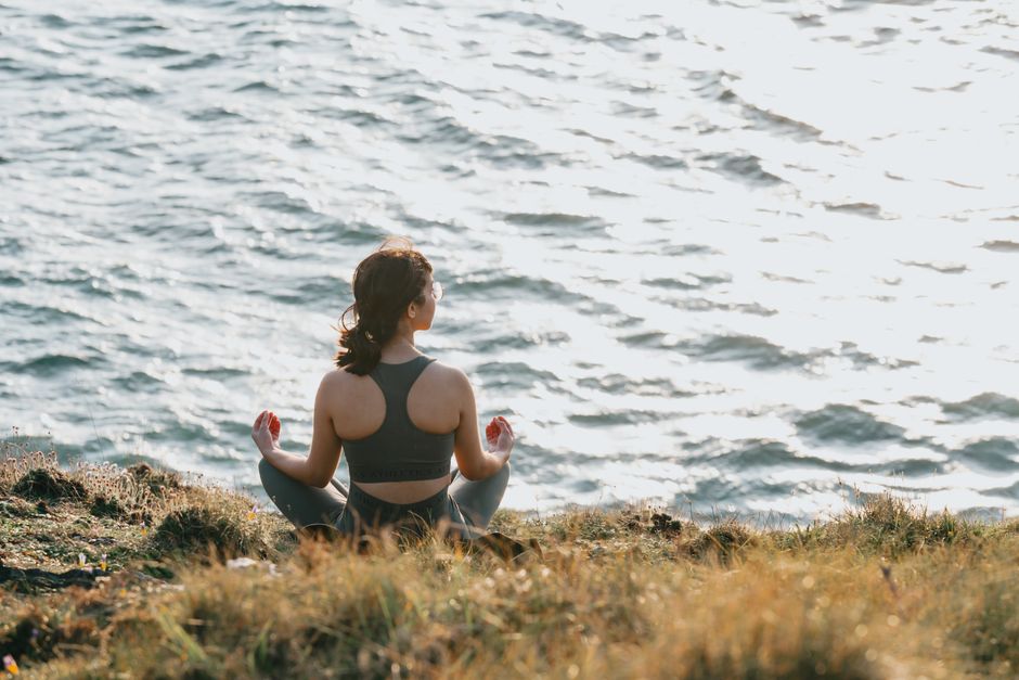
That matters right now because Rio's municipal health secretariat, the Secretaria Municipal de Saúde, reported in May 2026 that sedentary behaviour among adults in the Zona Norte jumped 12 percent between 2022 and 2025. The department responded by expanding its Agita Rio programme, a free guided outdoor exercise initiative that has been running since 2004 but received an additional R$3.2 million in funding for the current fiscal year to extend sessions into under-served neighbourhoods. More people need to move, and the infrastructure — extraordinary, underused, free — is already there.
Tijuca's Back Routes and the Gávea Granite Circuit
Start with Parque Nacional da Tijuca, the largest urban rainforest in the world at roughly 3,200 hectares. Most visitors go to Cascatinha Taunay or push to the Vista Chinesa overlook via the main road off Alto da Boa Vista. Locals know the Trilha das Paineiras on the forest's southern edge, a 6.5-kilometre loop accessible from Rua Corcovado in the Cosme Velho neighbourhood that winds through Atlantic Forest secondary growth, past three small waterfalls, and deposits walkers at a quiet picnic clearing that sees perhaps thirty people on a busy weekend. Entry to the national park is free for Brazilian residents with a CPF document on weekdays.
Further south, Pedra da Gávea offers a circuit that most visitors skip entirely in favour of the more Instagram-legible Pedra Bonita trail next door. The Gávea granite circuit, accessed via Estrada da Gávea in São Conrado, climbs 842 metres and takes between four and five hours round trip. It demands scrambling over bare rock in the final stretch — there are fixed ropes — and delivers a 360-degree view that takes in the Atlantic, Lagoa Rodrigo de Freitas, and the full sweep of Barra da Tijuca. The Instituto Chico Mendes de Conservação da Biodiversidade, the federal body managing the national park, requires hikers to register online before attempting Gávea; the registration is free and takes under five minutes at the park's official portal.
The Zona Norte's Forgotten Green Corridor
The trails around Floresta do Mendanha in Campo Grande — about 45 kilometres west of Centro by car — receive roughly 800 visitors per month according to figures from Rio's municipal parks authority, compared to tens of thousands at Tijuca. The Mendanha forest covers approximately 2,400 hectares and contains a trail system that the Secretaria Municipal de Meio Ambiente has been upgrading since January 2026 with new waymarkers and two restored rest shelters. The trailheads sit off Estrada do Mendanha and are genuinely straightforward to reach by car or rideshare. Admission is free. Parking costs R$10.
For those without wheels, Parque Estadual da Pedra Branca in Jacarepaguá is served by buses from Campo Grande station and contains the highest peak entirely within any Brazilian municipality — Pedra Branca at 1,024 metres. The park's visitor centre, near Estrada João Silvério Trindade in Vargem Grande, runs free guided hikes every Saturday morning at 7 a.m. Guides from the Instituto Estadual do Ambiente lead groups of up to twenty participants, and the treks typically cover between eight and twelve kilometres depending on the route chosen.
For anyone looking to start, the practical steps are simple: check the Agita Rio schedule on the Prefeitura do Rio website, register for Pedra Gávea access through the ICMBio portal if that's your target, and carry two litres of water minimum regardless of the forecast. The trails are best walked between April and September, when rainfall eases and temperatures sit in the low-to-mid 20s Celsius. A doctor or local sports medicine clinic — the UPA units across the city offer basic fitness assessments — is worth a visit before attempting anything above 700 metres in elevation. The forest will be there. Start before the tourists find it.